The final days on the Colorado Trail

July 20,

18.9 miles

356.0 trip miles

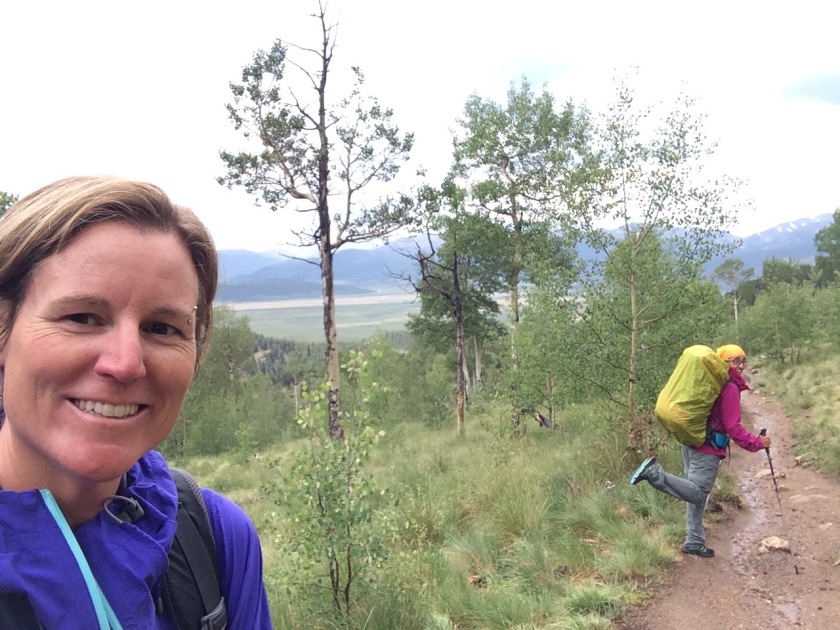
I didn’t get much sleep for having to run to the bathroom every couple hours. Food poisoning? Segment 4 started out in tall pine trees and we remained in them most the day. We were trying to out run a thunderstorm, but by 5pm it caught us and two other hikers. We were hunkered down in the trees while the lightning and thunder clapped overhead, terrifying Dizzy who normally can’t hear a thing. After an hour we were all soaked and carried on behind the storm. The other two hikers stopped for the night and we planned to camp just over the saddle we were approaching. Once at the saddle, round two of the storm hit us with a vengeance! We hiked as fast as we could trying to descend in elevation. It didn’t help and all the possible spots to camp were a wet mess or had flash steams flowing through them. About 9 pm, we found a flattish spot and set up camp as fast we could as it was still raining. Miren built Dizzy a lean-to and we crawled in the tent to settle for peanut butter and jelly sandwiches for dinner. Me, having to force it down as I was nauseous and still running to potty every couple hours.

July 21

12.5 miles…the slowest we ever hiked

368.5 trip miles

It was a cold hard wet night in the tent and I couldn’t seem to get up even though I didn’t sleep much. Finally after choking down a few nuts we hit the trail about 10 am having 12.5 miles to go to the van and a little comfort. It was the most difficult 12.5 miles as I was dragging and couldn’t get any food down. Miren kept encouraging me and dragged us through the miles and we finally made it to the van about 4 pm as the rain set in again. The storm was so bad that two bike packers resorted to spending the night in the outhouse to stay dry. Yuck!

Miren and I had to debate what to do. I was not feeling any better but all we had left was segments 1-3, about 38 miles. In the end, the next morning we drove to a pharmacy and then to Molly’s in Boulder. A couple days of puking and bathroom runs and my appetite was back. So back to the trail we head.

July 27

12.7 miles

381.2 trip miles

Today was an up down day. The drive to the trailhead was through a gorgeous canyon along the South Fork river. We met several hikers who were just beginning the Colorado trail. This was segment 1 and we were hiking the dog alternate route, which is a 4.5 mile side trail that parts from the CT ending at the Indian creek campground. Being lower in elevation, we were in trees all day with no real views to mention.

July 28

11.7 miles

392.9 trip miles

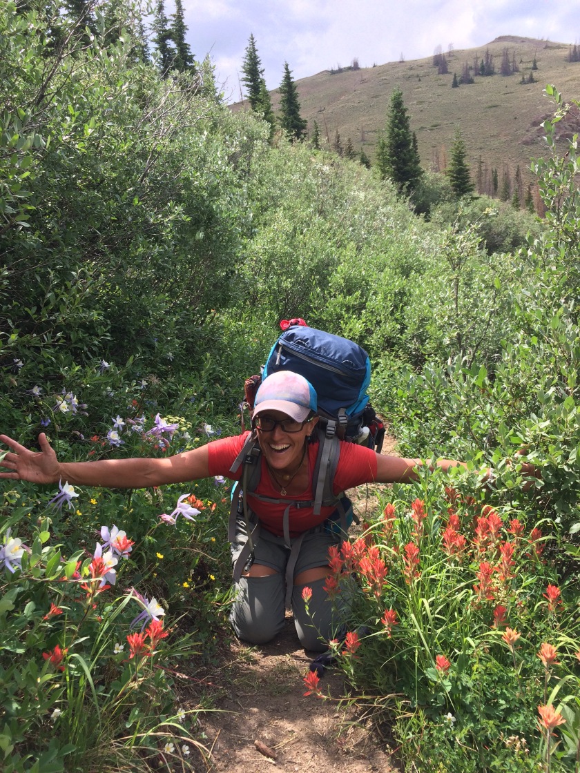
Segment 2; we had been warned by many that this was a dry section that had burned and everyone complained about it. We loved it, lol! We started about 6:30 am to beat the heat and loved the open rolling hills with random rock features jutting out along the way. There was a herd of mule deer that crossed our path and the openness made us giggle after being in trees the day before. It only took us until 10:30 am to hike the whole section so we got to spend the afternoon lying in the sun and shade along a river.

July 29

12.2 miles

405.1 trip miles

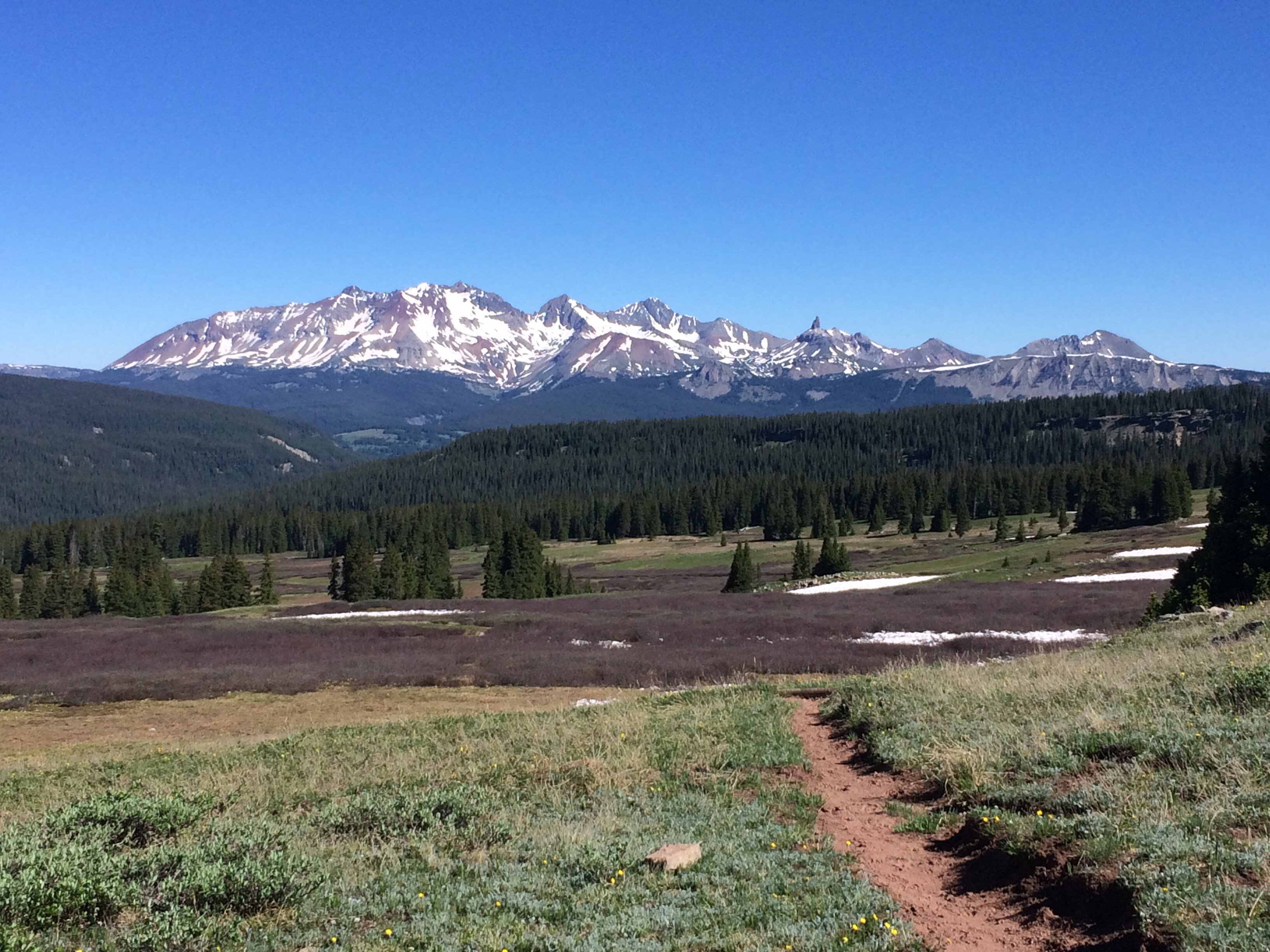
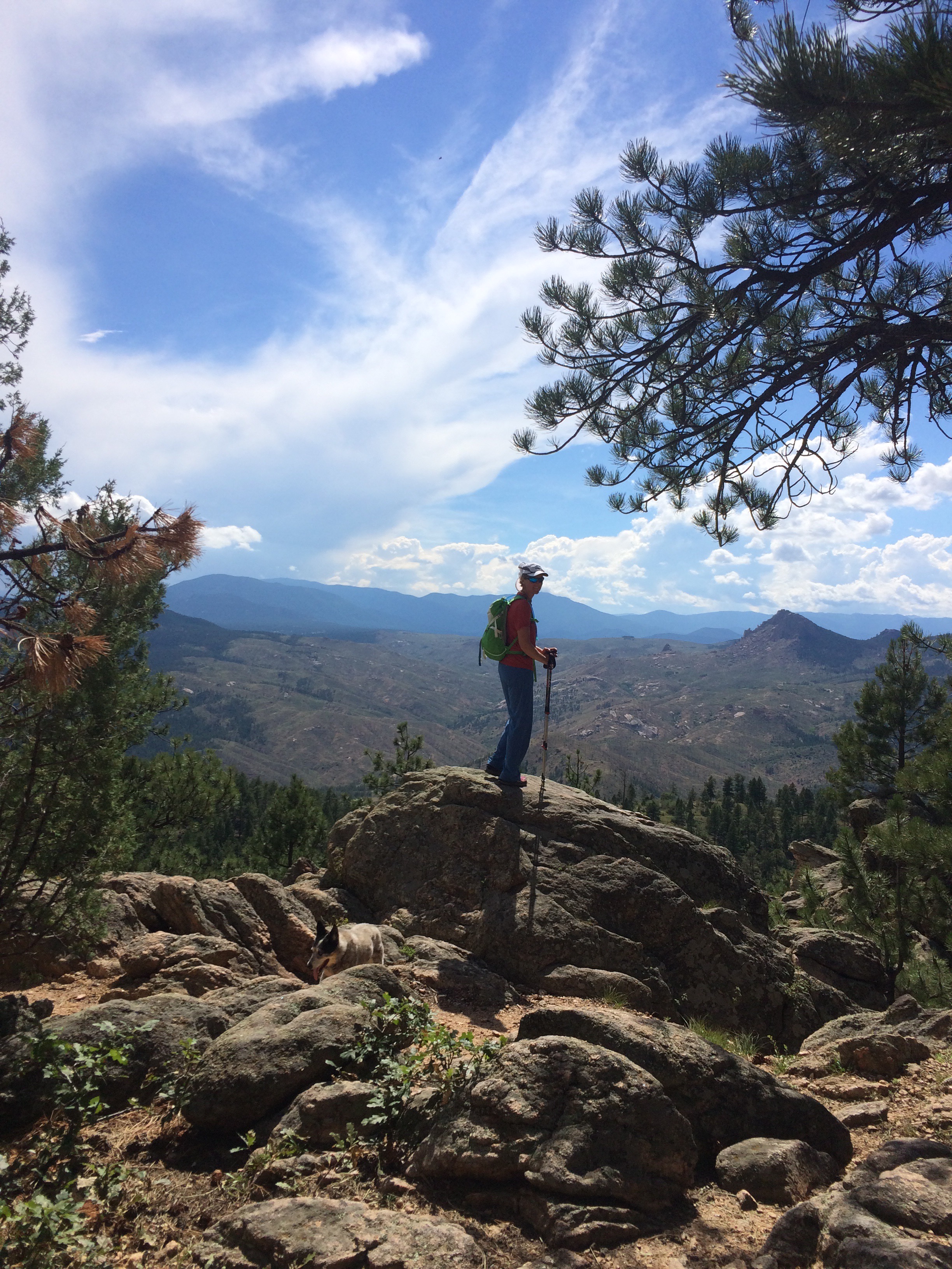
The last day of our journey. Segment 3 wound through the pines with lots of other roads, trails and camping spots crossing its path. Being a Saturday the trail was full of mountain bikers. I’m sure they were as frustrated with hikers as we were with most them. Going such different speeds, it almost becomes a hazard for both. Most were polite and would yield the right away if we we slogging up hill. A few others made our experience a bit annoying, making us want nothing more than to be done with the section. Some wouldn’t brake at all going downhill, forcing us off the trail or risk being a handlebar ornament. Mixed trail use can be a bit crowded on the weekends near the front range…aka, Denver side of the continental divide. About noon we finished up the hike and touched the signpost marking the end of our journey! Yippee!

We drove back to Grand Junction and I should mention my stomach problems had returned for the last three days of the hike. On Monday I went to my doctor and four hours later was informed I had both giardia and another stomach bug, Hpylori. I’m on the road to recovery now, but let me tell you, it’s not a pretty or fun process. With that diagnosis and the fact that we are flying to Europe in September for a month, we decided against hiking the western colligates. I think next summer we will hike that section with Dizzy…she really wants to say she hiked the whole thing. 🙂

Kenosha Pass to Frisco, still hiking the Colorado Trail


July 17 Day 20
12.5 miles
301.1 Trip Miles

After enjoying too many waffles, hard boiled eggs, and yogurt, we made our hour drive to the next trailhead section at Kenosha Pass. At the grocery store we both were craving veggies which was evident by the salad, humus and carrots I was packing in for our first nights dinner. We didn't hit the trail until 100pm planning a 10 mile day. Seven miles in we stopped for a break and met Dawn, a retired wonderful woman, solo hiking the trail. We loved all the adventures she has been on in her year, so many that she inspired her husband to retire 3 years early. An hour later we realized we should put in a few miles and ended up going all the way over Georgia Pass and found the perfect campsite.
High, open, with just a few Christmas style pine trees sprinkled about…and facing west. We enjoyed an amazing sunset on the big screen.


Dizzy begging for a snack any chance she got.

July 18 Day 21
26?….
327.1 trip miles

Even though the trail rises and falls thousands of feet several times during the day, it is so well graded that we are not burned out after a few miles. We knew we had 20.2 miles to go to segment 27 near Breckinridge…where the Peak 2 fire closed the trail. The way around is either taking the free bus skipping the 13 mile segment or walking the bike path through Frisco to Copper Mountain to regain the trail. Well, dogs aren't allowed on the bus so we decided we would walk the bike path and find camping along it somewhere…hopefully. We reached the closed segment at 4 pm and began the bike path walk. There was no information or signage to let CT or CDT hikers know where to go, how far to water, or if there was anywhere to camp. Hmmm, it would be a 33 plus mile day to the van. By 6 pm we were approaching Frisco with only the thought of pizza and a cold beer keeping our feet going. We didn't see another hiker in the entire stretch, and our feet were screaming at us for walking on pavement. We scarfed down some yummy pizza, drank a PBR and decided to try our luck with the bus driver. We had been hinted to just say Dizzy is a service dog and the drivers won't say a word. Being our honest selves, Miren asked the driver if we could bring Dizzy on the bus. He practically told us to say the magic words "service dog". And when we did he said, perfect magic words. Guess it's a liability thing. We were grateful to not have to walk another 7 miles of pavement.

July 19 Day 22
Rest day

We slept hard after our long day yesterday. It seems we grow more fond of Greengo, and all her amenities each time. We brewed up some coffee, had breakfast and took our time heading out from Copper mountain. Slipping into the grocery store in Dillon, we picked up some goodies for dinner that evening, and finally got on the road to head back to Kenosha Pass. It was funny retracing our steps back to Breckinridge. The road almost parallels the bike path we walked yesterday.

Colorado Trail Copper Mountain to Twin Lakes


July 13 day 16,
7.0 miles near Copper Mountain
236.0

We took 5 whole days off the trail and went to Boulder to visit a friend, get new shoes, and cook some fabulous meals. We told ourselves we would or take a week off, but even Dizzy was acting bored and wanted to get back at it.

We hit the trail a little before 2 pm shooting for 8 miles. About 6 miles in we realized we weren't in southern CO anymore. A dozen people on the trail, many heading for the same mileage we were. At 7 miles we saw a great site and decided to stop, knowing the nights and days of not having anyone around were gone and not wanting to risk not finding a site before the pass 5 miles ahead. It was nice to stop by 5 pm, eat a kick ass sandwich we packed, do our German lesson and just take it easy. Today the trail crossed the ski resort for many miles in and out of beautiful tree groves with many bridges to cross all the creeks. We were spoiled by that. Tomorrow, back up over 12000 feet. 🙂

July 14 Day 17,
20.7 miles
256.7 trip miles
Camped just past Tennessee Pass Trailhead

Today was a day of leapfrog. There were a handful of other CT hikers we traded trail with a few times. The morning was blissfully open as we went over Kokomo Pass and enjoyed the views, and even the tiniest bit of snow. Several hikers opted to hitch a ride to Leadville as the rain was coming in and didn't look like it would break. We pushed on and found a make shift flat spot where we quickly put up the tent and built Dizzy a lean too out of the small tarp. After a little coaxing she realized it was a nice little spot to curl up and sleep. We cooked in the tent and called it a night, trying to break the damp chill.

With everything that happened on this day, forgot to mention a fox came down the trail right at us….with a squirrel in its mouth. I though the darn thing was going to run us off the trail but eventually (20 feet from us) it scurried off.

July 15 Day 18,
19.4 miles
276.1 trip miles
Camped on east bluff 5 miles north of Mt Massive Trailhead

Woke to a lot of wet, but the sky was clear. Sun wouldn't reach our spot for hours so we packed up wet stuff knowing we would take a late morning break to pull it all out to dry. About 930 we came to a clearing and did just that. Amazing how 5 minutes of sun and a light breeze can dry the tent and sleeping bags. The trail is now very well graded, making the miles fly by smoothly, even though most the trail is in trees without the amazing views. We are learning to look ahead for passes or ridges to plan our lunch breaks…yes, sometimes we do more than one lunch a day! We ran into Knock Knock, Flyballs, and Franklinstien again and stopped to chat for a while. They seem like a fun group of CDT hikers. They have about 1700 miles to go at this point to make it to Canada. About 6pm we were taking a quick break at a nice campsite when another couple out for a weekend hike came by. I could see in there faces as they approached they were looking for a camp-spot and didn't have it in them to go on. I let them know we would be moving on and they were perplexed and grateful that we were not taking the site. The wife told us about some Hershey kiss trail magic she had left at the trailhead ahead of us. We would be enjoying that in the morning. We went on hiking a few more miles and found a great spot, treed along an east facing bluff. Perfect to get early morning sun.

July 16 Day 19,
12.5 miles to a shower
288.6 trip miles

Up before the sun, inspired by knowing we would have a sunny day to hike to a shower in Buena Vista. While packing up the sun came over the mountains miles and mlles away to the east. Beautiful. We were on a roll, hiking fast but not meaning to be blazing down the trail. Before we knew it, we were 6 miles down the trail enjoying a couple Hershey kisses, and then on we went. It was a quick morning getting 13 miles to the car by 1130. The break in Buena Vista was luxurious. Hot tub, shower, and we timed it perfect to sit in the room and drink a beer and watch the men's Wimbledon finials. Miren was in Bliss.

Didn't know it then, but that burger would come to haunt me in a few days…or so we think it was the burger…. to be continued on that.

Colorado Trail: Monarch Pass to Spring Creek Pass 101.4 miles


July 2 day 10 on the trail10.6 miles

138.2 trip miles

Spoiled in our queen bed, we slept in until 7:30, made a big breakfast and slowly began packing our bags to hit the trail. It seemed we were the second attraction to the Continental Divide, we had so many people come over and chat with us about the van and our travels. It was noon by the time we were hiking, but that was good. Our goal this time is to SLOW DOWN, well maybe not walk slower but do less miles each day. We have to remember we aren’t in a hurry and we aren’t in our 20’s either. We may need to let our bodies adjust. For Miren and I, it’s hard to have our 15 miles in at 3 and not look at each other and agree to just keep going. The trail has changed, the snow is nearly nonexistent and makes the scenery…different. I have to say, I like the contrast snow gives, and that is one of the biggest reasons I pushed for us to start hiking when we did in June. We could see snow capped mountains in the distance and chatted about how we hoped the trail would be taking us there. Now for a shocker, we are sitting at camp and made a fire for the first time! I’m not big on fires while packing, usually cause I’m ready for bed, but today we made camp at 5 and had a bunch of time. We finished our sandwiches, ate our dark chocolate dipped in a peanut butter cup (which conveniently must of fallen out of someone’s pack… hey don’t judge, we were simply picking up someone else’s litter), and started a fire. It threatened to rain all day, but the sun is rearing its head one last time, and the birds are singing all around us. A peaceful end….


July 3 Day 11 

15.6 miles

153.8 Trip Miles

We spent the night at Marshall pass and headed up the hill. The day started slowly and before long we were engulfed in trees. And then more trees…. and then more, dead, trees. It was difficult to “be inspired” in the tunnel of trees. It’s not that I don’t like trees, but the density was almost suffocating. Additionally the trail consisted of large loose rocks over steep ups and downs. Several times we slipped and fell. The afternoon winds kicked up plenty of dust and the trees creaked eerily. With the number of already downed trees, it was motivation to keep moving. We finally got to a stream where we filtered water and washed our feet; in that order, didn’t want to take chances. The miles were so painfully slow we needed a break. We eventually trudged on barely reaching our mileage goal. At camp, we hoped to relax but the bugs and wind were relentless. And then, Aimee lost her balance and came out of her flip flop. Her arms were flapping as she tried to keep from falling into the camp fire. She managed to regain control but unfortunately stepped down on the pot holder, slicing her heal. Now if you could see her backpacking feet you’d know that was the last thing she needed. It was truly a brutal day, and we were both ready to put it and us to rest.  

Dizzy’s face says it all

July 4 Day 12 

17.6 miles

171.4 Trip Miles

We wanted a little independence from the trail… I shall explain. I didn’t sleep, for the second night in a row. On trail I don’t hurt, but minutes into lying down my lower back and right leg (sciatic nerve maybe) scream in every position. Getting up, Miren was very concerned as was I that I wouldn’t make it the 76 remaining miles if I couldn’t sleep. Plus we were concerned how hard the rocky trail was being on Dizzy’s paws. On with her booties and we decided to do a couple miles and assess how we were all doing. In those miles we ran into Knock Knock, Flyballs, and Franklinstien, three hikers we had met before. They gave us some encouragement and we pushed on through the trees. Segment 18 of the trail allows motor bikes and the trail is designed to go from valley to peak of each hill in its way, with no switchbacks. It beat us up but we pressed on. About 4 we stopped for an afternoon break and met a retired couple out for a 2 nighter. We ended up chatting for an hour and in the end they gave me an Advil PM and some stretches to try. They camped there and we moved on for a few more miles to be closer to a water supply for the morning… and coffee 🙂 It was a hard day, and in the end, it was making acquaintances that motivated and inspired us to push through, knowing not everyday on the trail is going to be full of big vistas and smooth downhill trails.  


July 5 Day 13 

20.4 miles

191.8 trip miles

The Advil PM worked it magic. I slept most the night and woke with a smile ready to hike to a creek so we could make coffee. The trail opened up today and the miles flew by quickly. Early on we ran into a lady who dropped her husband off to walk 7 miles of the trail before she met and picked him up. Mind you I have been wearing long sleeves and pants, and trying to shade my face as much as possible but on this day I had zinc sunscreen smeared all over my face to be sure. I must have looked pretty rough because when we crossed the dirt road 7 miles later, there be the lady. We chatted and I inquired, sounds like your cooking lunch, as I could hear the propane running in the camper. She replied, no, she had turned on the hot water heater so “you girls could wash up if you like”. Hilarious! And very sweet. We didn’t take her up on the offer, didn’t want to ruin a washcloth lol! And don’t want to re apply all that sun screen. It was tempting tho. After dinner another deer, a doe this time decided to visit us as we watched the last light of day dance off some cliffs in the distance.

Grandma, and grandson packing a section. They had gotten lost and were a bit frazzled and a day behind schedual
Something smelled good, and I knew it wasn’t us.


July 6 Day 14

17 miles

208.8

Excited to hit the trail with the possibility of bathing in an upcoming creek. Hey, it’s the little things…like cleanliness that count. And we NEEDED as bath! Cochetopa Creek was freezing! But refreshing. The trail was a nice easy uphill grade all day along the creek off and on. It started to spit a little rain on us in the evening so we pitched tent at a beautiful spot 17 miles in. We built a little shelter for Dizzy and cooked up dinner in the tent. My day was not yet to be over tho unfortunately. After hours of camp pad aerobics (as I am now calling it) trying to get the pain in my back and leg to go away, Miren woke at 2:22am and asked if I wanted to get up and hike. The moon was so bright she thought it was morning. I was frustrated and tried for a couple more hours to sleep before we got up to face a big day if we wanted to reach town.


July 7 day 15

20.2 miles

229 miles

Faced with 20.2 miles to the car, it seemed doable after the 20 mile day we were putting in. But this 20 miles would hold over 5000 feet in elevation gain and over 4000 in decent. Plus a treeless Mesa 7 miles long and at over 12500 feet that we would reach in the afternoon…as thunder clapped over our heads. It went from shirt soaking, staggering hot to upper 30’s with blowing rain in less than 30 minutes. Just shy of the high point, we hunkered down in some shrubs to eat a snickers and watch to see what way the storm was moving. It was moving our direction, but luckily, fast. We waited it out and then followed it up over the mesa, grinding out fast miles, wanting to reach the car, and then Lake City before the restaurant stopped serving food. We made it by 8 pm and both reflected at how beautiful the view was from the Mesa as the sun set behind the clouds over Uncompaghre and Wetterhorn, 2 of CO’s iconic looking 14rs. It was midnight by the time we drove back to Monarch Pass where the van and our comfy bed awaited us. 


A few nights back I noticed a tear in our tent. Between that and both of us needing to get new/different shoes, we are going to make a run into the Denver area for stuff. Hope to be back on the trail in a few days. Also we heard there is a fire near Breckinridge that has closed part of the trail. Need to find out how that may affect us on our next section.

Colorado Trail Spring Creek Pass to Molas Pass

CT Day 6 June 27, 20172.8miles

Trip miles 76.0


We took a “Nero” day which meant doing laundry, shopping, repacking and driving to the trailhead. It was a busy day and we felt a little stretched for time. We didn’t get to the trailhead until 7:30 pm. We briefly discussed sleeping by the trailhead but eventually decided to head out and hike a few miles before dark. It was a calm, clear evening. It felt nice to get our feet back on the trail again. We came to a nice clearing and decided to set up the tent. It was surprisingly cooler than expected. This would become a theme for the next few segments. 


CT Day 7 June 28

19.5 miles

95.5 trip miles

“It’s freezing!” Neither of us slept well last night. The temps dipped below freezing and we weren’t able to shake the chill after crawling into our sleeping bags. Dizzy’s bowl was frozen and we’d slept through the alarm, or perhaps it too was frozen. We pulled ourselves together after enjoying a warm cup of coffee, and headed out. Since we woke so late, we were determined to cover some ground. The landscape was so different from what we had previously seen. Massive, open tundra with distant peaks and lakes. We stayed above 12000 feet all day and passed the high point on the entire trail at 13271 feet. We saw a couple of elk bounding through the shrubs. Part of the trail was an old jeep road so we were able to walk along side each other. Soon we crossed paths with the first of several CDT hikers. Some of their names we recognized from following trail journals. After chatting briefly, it was back to the grind. By evening the winds were whipping and we hiked as far as we could to get down in elevation. Still above 12000′ Miren used the rocks from a trail cairn to surround the windward side of the tent. Any little bit to hopefully help us sleep through the gusts. We had to cook our dinner in the tent vestibule and were happy to go right to sleep.


Day 8 June 29

18.1 miles

Trip Miles 113.6
Rise and shine, the wind died down and we have another blue sky day. The day was full of ups and downs, a couple mile climb just to decent the other side. As we reach the top, I like to say “I wonder what this window will bring”. Each time the view of the mountains ahead changes as you drop into a different valley. We crossed lots of sun cupped snow fields that are so interesting. How do they form such deep bowls. We were thankful that for most the day they were firm allowing us to walk over them. By afternoon though, I took 3 falls. Usually I fair pretty well on the snow but it had my number this day. Bruised elbow, twisted ankle, chapped hide, and I just had to roll with the punches. We wanted to camp about 16 miles in near a lake. Unfortunately, the ground was saturated for miles and the wind was howling so we had to hike on. We reached the ridge above our final canyon and looked down to see dozens of switchbacks dropping us into it. We got to hiking and pitched our tent at the first semi flat spot we found, happy to be down a bit, out of the wind. The view was unspeakable. Hopefully the pictures do it some justice. Lakes on a flat rim of granite hovering over a deep canyon dropping thousands of feet with a red granite wall reflecting the last bit of sun on the other side.

Day 9 June 30

14.0 miles

127.6 trip miles
The granite walls towered above, shielding the tent from the warmth of the sun. We couldn’t believe our luck having found this camp spot in our exhaustion yesterday. The eight mile descent was steep and rocky, finally opening up to a valley with more stunning views. We eventually crossed the railroad tracks where we decided to take a break. Our timing was uncanny as we heard the “toot” of the locomotive and began waving at all the passengers on the train. After a quick lunch, we threw on our packs and slowly started making the final 2500 foot ascent up Molas pass where the luxury of the van awaited. This time for dinner we were craving a pasta with lots of veggies and as a side, roasted brussle sprouts. 


July 1 ZERO DAY!!
Well zero miles anyway, but we went and did laundry, grocery shopped, and drove to Monarch Pass where we will pick up our next 102 mile segment hiking to Spring Creek Pass. And this next segment will have a 14er that we can climb as a side hike. San Luis peak, we have heard its only a few mile side trek.

On the Colorado Trail(CT), Days 1-5 Snow, Views, and Downed Trees

CT Day 1Little Molas Lake to Cascade Creek

14 miles
On the trail at 645 not sure what to expect of the snow on the trail. We had a pass to go over at 10 miles in. We spent 2 miles on the north side going cross country through snow and were surprised to have to travel across snow on the south side of the pass for over a mile as well. Sun cupped snow but rarely post holing. Just a 1/2 hour before stopping for the day,- we had to find a downed tree to cross a ragging seasonal stream. Once I got Dizzy on the tree she crossed better than us. We got to our camp site at cascade creek and were welcomed promptly by monsieur marmot camp host. He seemed a bit surprised, like he wasn’t expecting us, peaking at us from the bridge. Enough about that.. For dinner we had beef ramen, with a little twist. We carried in a little broccoli, onion and mushrooms. Damn was it good!! Why didn’t I do that in college?!After lying on a rock and doing our German lessons we are now off to an early bed. Getting to camp at 330 is a bit too early for us. 
CT Day 2

Cascade Creek to tiny stream

15.1 Miles
After getting a very good night sleep in our four star tent spot, we hit the trail to have soaked feet by 7am, and they would not dry out all day for all the snow and swollen creek crossings. 10 miles in we thought we were making great time even with some trail finding and trudging through snow. Then we saw it, the north facing bowl to Blackhawk pass. It took us 2 hours to go 1.3 miles to the pass. It was completely snow covered making the traverse where the trail would be too risky. So instead we had to descend hard earned ground to then scramble up several hundred feet where the snow had melted to the base of the bowl. And then it was up the bowl itself, kick stepping stairs into the snow. I just kept working and avoided looking down. So glad we only have 30lbs packs. It was a butt kicker…but the views were stellar. We tromped on for a couple miles to find a spot to camp by the last reliable water source for 14 miles. It was a trickle of a stream but enough to filter water. Finding the only semi flat spot to pitch a tent we climbed in after our burritos to find it was too sloped to sleep. So back up we were, digging a flat spot with chunks of rock. Exhausted, we broke into laughter before falling asleep. The next person who comes along is going to love that tent site! Our motto for the day, embrace the suck. Lol


CT day 3

Tiny stream to trail junction mile 456.6 from Denver

17 miles
We decided to set the alarm for a 5am early start. By the third alarm which I had set, “just in case,” we finally stirred. I guess digging out our flat camp spot wore us out. We were off to a good start, deciding to put some miles under us before a big break. After yesterday, the trail seemed easy, rising and falling mildly and free of snow. Then the flurry of wind fallen trees began. Pretty sure we had to navigate around, over, and even under at least 50. That was a bit of a slow down and full body workout. We were rewarded with a beautiful spot to camp, tucked into a few trees just below a rim that gave 360 views. We had time and energy to read in the evening sitting on the ground. I glanced back over our shoulders and a velvety four point buck was walking past not 40 feet from us. He glanced at us and just kept at his casual pace. Mind you we stink to the dickens, he was down wind, and Miren was reading out loud. Guess he wanted in on the story. Fifteen minutes later he came back, this time walked toward us stopping 30 feet from us to eat some grasses. Crazy awesome! I moved to try and get a photo but sure enough he sprang away. The one I got doesn’t show his cool rack.


CT day 4

Trail junction 456.7 to 476.6
The sun started peaking through the trees early and was brushing the sky with hues of pinks, reds and blues. We sat on the hillside taking in the views, colors and our hot cups of coffee. This is bliss. The trail took us along a high ridge sprinkled with a few sun cupped snow drifts, lush meadows, and wildflowers. We were beginning to wonder how long today’s hike would take us. We couldn’t stop taking pictures and admiring the 360 degree views. Stunning doesn’t really do it justice. As we approached Taylor lake, the trail disappeared beneath large mounds of snow and we found ourselves cautiously skirting around the snow. Even our dizzy girl was sliding with her “four wheel drive.” Once through that section, it was relatively down hill and apparent that the “thaw” is on. Much of the trail was wet or simply had turned into a seasonal stream. Beginning our descent towards Durango, we were looking down into a sea of green timber. We’d been informed that a trail crew and just been through and cleared many fallen trees. Music to our ears! The trail wound through the forest, up and down, crossing several streams and was very dense in places. We were hoping to find a camp spot but found ourselves engulfed in too steep of slopes, and much vegetation. Before we knew it, we had hiked up the last high point of segment 28, running smack into the trail crew. It’s always nice when you can personally thank the people who keep the trails open. We chatted with them for a bit. They had cleared 150 trees from a 17 mile stretch of trail. Wow! We were only 10 miles from Durango but wanted to spend one more night under the stars. And finally as though someone had heard our thoughts, we found a great little campsite. What was supposed to be a 15 mile day turned into a 19.9. It’s was so worth it!


CT day 5

Final 7.2 mile push to burgers
Our final day. And since we had done more miles than intended yesterday, it was an easy day out. We were so tired last night, we had skipped eating our dinner. So it was Thai curry rice with coffee to power us to the parking lot. There are certain combinations you would never think would work, but sometimes a girls just gotta eat! We got off to a lazy start, deciding to enjoy our morning and the view. We knew we could easily cover the miles before noon and LUNCHTIME! For some reason, both of us were craving a Big Mac and fries. Normally I would shun such food, but after nearly 75 miles, all I could think was, “bring it!” Then it was errands and back to the van for some more food (roasted veggies and potatoes followed by popcorn) and our first beer in five days. Ahhh. Try to relax for the evening before hitting the trail again tomorrow evening.

Last stop before starting the Colorado Trail

May 30
Mesa Verde National Park… neat, but Miren and I have a funny little saying…same ol’ petroglyph. Not really, but for us, once you have seen 50 ancient dwellings you have seen them all.

May 31- June 3

Rising early we rode Phil’s World trails (Cortez, CO) before the masses hit the trails. Then off to Junction for a few days via highway 145. A stunning quiet drive through the mountains, pulling at us to stop and explore.
June 4 2017

We finished up our stay in Junction by getting new tires. After reading that everyone who wanted to put bigger tires (265) had to cut away part of the wheel well, we decided to see for ourselves. Firestone tire was nice enough to throw the front on to make sure it would clear and wahlah! We now have an inch more clearance.  We ventured up the Mesa planning to hike Craig’s crest only to find that it was still largely covered in snow. We geared up and gave it a go. Dizzy ran circles around us and we turned back after a couple hours of postholing, hiking thru a river covered trail, and not having any further indication if we were still even relatively close to the trail that is under several feet of snow. Happy to get back for a late (830pm) steak and roasted veggies dinner. Have I mention we could not live (well) without our oven!


June 5

Up and over a forest road pass, we snuck through some snow drifts and made it to Avery Reservoir to camp for the night. Just before sunset the lake came alive with fish jumping and feeding on bugs, 1000’s of ripple circles at a time. 


June 6

Road Closed? Hmmm, let’s venture up this mountain pass anyway. As we approached the summit 20 miles later we were stopped by an impassible wall of snow. Wanting to see the view we hiked to the summit and could hear a snow grader working down below. After chatting with the operator I asked, “so when will this be passable?” He responded, “how about right now, I’ll go clear the last spot.” How cool was that, and what timing. We could then continue on to Steamboat Springs and didn’t have to backtrack hours around. Who knew this late in June so many roads would still be snow covered. An hour later we were on another dirt road pass unable to hear each other talk the hail was pelting the van so bad. Snow covered road once more.

June 8 
A few housekeeping items were needed. A couple new squeaks from the oven cabinet needed to be silenced so we could go on enjoying all the rough roads we like to explore. We started out heading for Lake City, but diverted down a forest road that lead us to a locked gate. As Miren was driving, I spotted a black bear(cinnamon color actually) and we got to see it run off into the woods. Found a nice camp spot with a view of the snow covered San Juans and watched a spectacular sun set to the west as the full moon rose in the east with a brilliant ring.


June 9

How to celebrate one full year traveling and jobless. We ventured to Crested Butte, took a nice hike, played a couple hours of tennis and found a great camp spot near Keibler Pass. For dinner we seared ahi and had broccoli, onion and carrots sautéed. Damn was it good!

June 10

Attempted Mt Crested Butte. 1.3 miles before the peak the trail was fenced and closed…too much snow! So what do we do after a 6 hour hike, go play tennis again.


June 11
Up and on the road early with coffee to grab groceries in Gunnison then head to Creede. One old mining town that actually survived and didn’t become a ghost town. Silver was their mineral of pleasure. It’s a beautiful location, a little downtown tucked tight to the canyon but opens up to a huge valley along the Rio Grand River. I don’t think I could ever like living in a tight canyon. The sun sets so early and rises too late. This area is much more open than Ouray, Colorado’s famed “Swiss Alps” town. 

June 12
We seem to be on a roll, camping at high elevation. We haven’t stayed a night under 9000 feet all week. Good conditioning for the Colorado Trail I suppose. Today we were surprised to find a fun little town we had never before heard of, Del Norte. It offered us a nice hike in Penitente Canyon in the morning followed by some mountain biking. Their brewery, which I have given up on breweries because they are a dime a dozen and rarely good, had great beer! I was surprised I liked both mine and Miren’s, and of a ten beer line up, only one was an IPA. Seems anyone can throw a bunch of hops in the kettle and call themselves a brewery so I was very pleased to find they had great variety, including a black lager. Okay, I’m rattling on about beer… We then back tracked, deciding to go checkout Pagosa Springs. The road over Wolf Pass is spectacular. In one turn we went from dense pine forest to an expanse of snow capped mountains. At the top is the Continental Divide, and the CDT which one day I hope to hike. So down a forest road we head to find a spot for the night. 

June 16

Happy Birthday Miren. Up at 5am to beat the melting snow of the afternoon.  We hiked Grey’s and Torrey Peaks, both 14ers that can be hiked together.  Wonderful start to the day and because we were done before noon we had time to grab a burger and beer at the Damn Brewery in Dillon. The night before we seared Ahi and broccoli for dinner. I love that our van menu is always growing. After the hike, Dizzy approved of our campsite by passing out by the fire pit where we could hardly see and find her. Don’t let her fool you, she kicked our butts up and down both mountains and then looked at us as if to say “just 2?”

June 19

We came to GJ yesterday to grab a few things. This afternoon we will head to Durango so that we can begin the Colorado Trail on Thursday. At 484 miles, I’m hoping all our bodies and minds (Dizzy too) will be up for the rewarding challenge.

Day by day for part of May

Black Dragon Wash, the only vehicle route through the Swell before I-70 was completed in Utah.
Not a soul for miles, I love the geology here

I thought I would mix it up a bit this time and try something a little different. I’ve been trying to jot down a few sentences everyday to help me remember all the little things that we have done.  It seems when you are on one long long vacation, its hard to remember all the places you go and it all starts to run together. When we sit down and think about it, it really is amazing everything we have got to experience in the past year. Yes, YEAR. On June 9 it will be one year since we started the road trip adventure. And on April 23rd we celebrated one year of living in the van. Overall, we are still loving it. Winter had us chomping at the bit to be out of the van but now that nice weather has hit we are loving it again.

One of many slot canyons to explore in the swell
Stemming required, specially since I don’t like getting in nasty water!

May 11

The not so big, big 40 for me. We had a rare calm and hot day to spend on our paddleboards at Sand Hollow State Park near St. George UT. Dizzy was a sport as we paddled around and out to the sandstone island.  Miren made me a new recipe, stacked shrimp enchiladas for my birthday dinner. Yum!

A peaceful view on my birthday evening
Dizzy has a rough life
Stacked shrimp enchilada birthday dinner

May 12

A day of laundry and getting chores done before meeting up with Jared from Inergy. He was coming down to take some photo ops with the van and our generator solar panel set up.

May 13

Jared introduced us to Gooseberry Mesa for some fun “intermediate” mountain biking and we discovered some stellar campsites. After, Dizzy decided she needed a 90 dollar 2 minute message. She scared us with not walking/standing. We drove all day to get her to Flagstaff and a vet that was open for the weekend.  In normal Dizzy fashion, she was better two days later and I told her she would not be getting such expensive messages in the future.

Gooseberry Rim, Utah

May 14-17

Visited my parents outside Phoenix, AZ.  Thanks to my dad, Miren and I now know how to change the brake pads and might even take on the rotors next go around.  Greengo is running smooth. Thanks Dad!

May 18

Today’s adventure was getting my folks out on paddle boards.  They were good sports wanting to try it out, not to shabby for some 60 somethings.  We got to see 4 road runners and a bunch of donkeys…I guess they are a staple attraction in the park now.  And we educated ourselves on the difference between a donkey, burro and jackass.

Lake Pleasant, AZ for a little paddling fun with the folks

May 19

Most the night I thought we were camped on Lake Pleasant instead of beside it.  The wind was fierce and usually we will face the van into the wind to keep the rocking down.  But the wind had a mind of its own and didn’t know which way to blow. We drove to Flagstaff and found some tennis courts for a little play before heading to forest land where we were lucky enough to score a camp spot all alone not far from tomorrow’s trailhead.

May 20

Our first climb of the season was a bit of a butt kicker up Humphrey Peak. At 12633 feet it is Arizona’s highest point. Interestingly, the 3400 foot climb was not a problem; the decent… or should I say the slip slide and glisading on our tooshes down the snow covered uppers with no trail markers, was a bit of a challenge.  After acting like death just last week, Dizzy shined. It wouldn’t be complete without her.

Summit of Humphrey near Flagstaff, AZ

May 21

Into Grand Canyon NP, but gladly the more remote reaches of Lee’s Ferry.  This is where the 40 mile Paria Canyon hike ends.  We had done that backpacking trip in 2015 and I have been wanting to return and take Miren down Cathedral Wash ever since.  Things have changed a bit, the trail is now marked and “NO PETS” allowed, but the canyon was still a fun decent in solitude down to the Colorado river as it begins its journey through the Grand Canyon.  To end the evening we parked out on BLM, a stones throw from Badger and Grand Canyon watching the dark clouds move in over the Vermillion Cliffs.

Cathedral Canyon…we were in the mood for some fun poses

Our Vermillion Cliff view home for the night

May 22

No visit to this area would be complete without waking at 5 am in time to watch the Vermillion Cliffs dance red as they are bathed in the first rays of the days sun. Our first visit to the North Rim of the Grand Canyon gave us the feel of magnitude. I was a sleepy girl so we opted for shorter hikes and fresh popcorn for 3rd breakfast. Today we gave Sass and Paperweight (who were thru hiking the Arizona Trail (AZT)) a ride from the trail to Jacob’s Lake so they could devour a big breakfast.  And ironically this evening we are camped on forest land not far from the AZT and have decided we will backpack a section tomorrow. I am very excited to sleep in a tent again, but a little nervous that it will be in the 30’s at night.

Unforgettable sunrise

May 23-24

As we plan to hike the Colorado Trail (CT) this summer, we are seeing how well Dizzy will do as she is getting up there in age.  We set out on the AZT near a view point that overlooks the northern reaches of the Grand Canyon. Planning on keeping is a mellow day, shooting for 8-10 miles, we stopped 14.25 miles later to make camp.  🙂 As long as we plan on carrying Dizzy’s food and jacket, I think she will do fine on the CT. Early mornings and cool evenings, she is like a puppy making us wonder why she isn’t carrying our food! We stayed cozy warm but woke to a frost covered tent and the remaining water in the dog bowl frozen.

Heating up our curry for dinner, Dizzy is supervising as usual

From the north rim of the Grand Canyon, snow covered Humphrey peak could be seen in the distance.

Earlier in the month we had a different kind of adventure. Stuck a couple nights in a little town in Utah because the ignition lock stopped working. After a 160 mile tow to the closest shop that has computers to work on Mercedes, we are happy to report we did not hit any overpasses, just nearly took out some power lines in town.

Spring. One of my four favorite seasons.

Black Canyon of the Gunnison showcasing Miren on rock.

One of Miren’s biggest fears when she met me was that I was a “snow bunny.” After dragging ourselves from snow storm to snow storm we both can agree we love the arid desert, especially in spring. The cacti are blooming and every color of flower can be found. The air smells clean with the hint of rain threatening and the late morning sun feels like it’s cooking the skin.

Mountain biking Near Moab

After traipsing about Mesa County for most of March and April, looking for a piece of land to call home we have fled to Utah for a little escape. Arched rock hikes, slick rock mountain bike rides, discovery hikes up unnamed canyons, and evening walks in flip flops that turn into miles of cross country adventure. This part of the country is a mystery to me.  In a few hundred feet the soil/rock can change from crumbling benanite, to flaking shale, to yellow slick rock jutting hundreds of feet above with veins of red swirling through it.  This morning’s coffee is enjoyed while watching the sun and shadows dance on the eastern face of the San Rafeal Reef. 


Yesterday we biked over old 4×4 roads to Black Dragon Road, the original route through the San Rafeal Swell before I-70 was cut into a canyon further south. It was gorgeous with many hundred foot red and black sandstone walls as little as 50 feet apart.  Cottonwood trees grew where the canyon was wide enough and small seeps of water still fill parts of the canyon floor.  The old dirt road is now passable by only the gnarliest of vehicles for at times we had to hike our bikes through washed out sections. And in the middle of this two mile section of steep canyon are some petroglyphs.  Can anyone tell me why, no matter the distance apart, petroglyphs often resemble others from states away?These were the boxy alien looking type with 3 lines coming out of the head resembling antenna. Just last week we visited Dinausaur National Monument hundreds of miles away with similar creatures draw on the sandstone…and lizards, tons of lizards. Or were they crocodiles? Guess we will forever have to guess what they were drawing. 

Morning coffee with Outside and Sunset magazine

Dinosaur blew both of us away, and not just the 40 mph gusts we were enjoying that day. There is a quarry of Dinausaur bones encased in a building for all to visit the size of half a football field. The area was believed to be a riverbed back in Dino’s day and mud preserved the bones like a packed graveyard. As neat as that was, both Miren and I were amazed by the homestead further up canyon that was established by a lone woman whose children were grown so she decided to etch a life for herself out there. What a hard yet fulfilling life that must have been. She lived there 50 years alone nearly up until her death pushing 90. 

Those would be dinosaur bones.

Pioneer and explorer stories have always fascinated me. Standing in the great open west, looking out for miles trying to envision what it must have been like to pick a path across such vast ground with sheer canyons and cliffs cut into the landscape, often unseen until one stands upon it.  A different bread of human, inspiring.

The entry of Crack canyon
Some of the easier down climbing in Dang Canyon
I will do about anything to avoid getting in that nasty water

We skied our way to sunshine


Sitting in the sun, enjoying a view of the Colorado National Monument while sipping coffee. Now this is an enjoyable morning. I’ve had my share of snow for maybe a lifetime and gearing up for a bike ride in 80 degrees today sounds fabulous. Our tour of the 9 ski resorts we have hit up so far was amazing and challenging. Of 15 ski days, we had 10 pure powder days. Miren perfected her head roll on her snowboard by the time we hit Sun Valley.  After forcing her fear filled face to drop into an untouched line on one of the bowls, she was hooked on the white powder.  By the time we hit Jackson Hole, I had Miren skiing the black diamond glades like a champ. Now when there is a foot of fresh powder and it’s still falling, it feels like a dream and the steep slopes feel just right to make puffy turns while skimming off granite and brushing past monster pine trees.


We had the privilege of choosing to ski a day or wait based on the weather.  In Whistler we actually had to have the back doors of the van cut open.  The humidity and freezing temps froze the door latch and the striker was in the closed position when we shut the door. This makes it so even if you tear the door apart, no easy feet when you have a queen size bed in front of it, and defrost it, it still will not release from the center striker latch.  Luckily the day we spent getting the door open was when the snow began falling and the following day we enjoyed powder before it turned to rain in the afternoon. I have skied Whistler before and that is the biggest draw back; it is so low in elevation and near the ocean that getting a true powder day is hard to come by. By 1 pm expect to be skiing mash potatoes at best, cement more likely.

Just needed some sunshine!
Looking out at Grand Junction from Independent Monument.
Our campsite in Rabbit Valley. Pic taken from the ridge where we had morning coffee.

In Utah we got lucky again with powder days and I even took Miren out on ski’s so we could go to Alta. They do not allow the knuckle dragging snowboarder types.

Over all it was a great experience, but one we will not try to repeat. We know first hand why you do not hear of people traveling in the snow skiing all winter.  They head south, to soak in the sun like we are doing now back in beautiful Grand Junction.  We spent last week in Rabbit Valley, a 1/2 hour out of town, hiking, mountain biking and drawing out our future home in the dirt. 🙂 Yes, we are starting to make steps toward having a home base that gives us the freedom to travel and explore but also have a stationary home to come back to. More on that to come as the planning and build process come together.  A glimps though is it will be in Mesa County, CO on some acres with 360 views and we will do most the build of a 560 square foot home ourselves. (504 livable square feet). From one adventure to the next, right? It’s what life is all about!